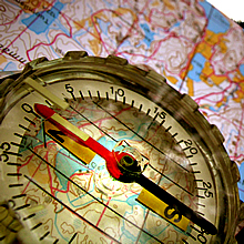
Online Mapping is designed to provide members of the public with access to Cannock Chase District Council's map based data. This Geographic Information Systems (GIS) displays council map-based property-related and service information.
Access our online mapping system here
Address Searching Facility
Searching for an address is based upon the Local Land and Property Gazetteer (LLPG). Please note that this facility is continually undergoing regular updating and maintenance.
Please see below for terms and conditions for address search facilities.
Ordnance Survey Copyright
The base mapping and aerial photography is reproduced from Ordnance Survey material with the permission of Ordnance Survey on behalf of the Controller of Her Majesty's Stationery Office © Crown Copyright. Unauthorised reproduction infringes Crown Copyright and may lead to prosecution or civil proceedings. Cannock Chase District Council, Licence Number 100019754 2011. The Ordnance Survey mapping included within Chaseonline is provided by the council under licence from the Ordnance Survey in order to make electronic council available to the public. Persons viewing Chaseonline Mapping should contact the Ordnance Survey for advice if they wish to use Ordnance Survey map data for their own use.
Accessibility
Cannock Chase District Council strives to meet the needs of computer users with visual impairment or other conditions that limit accessibility. Due to graphics-intensive nature of this part of the site, this geographic information cannot all be presented in an accessible format. If you would like assistance with this please contact:mapping@cannockchasedc.gov.uk.
